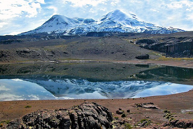

The Coropuna volcano in Arequipa registered four daily earthquakes between July 16 and 31, according to the Geophysical Institute of Peru (IGP).
This volcano is located between the districts of Viraco, province of Castilla, and Salamanca, province of Condesuyos. It is considered as the tallest in the country and of very high risk.
According to the first report of activity of the Coropuna, prepared by the IGP, the telluric movements have their origin in the fracturing of rocks within the volcanic massif, which are known as volcano-tectonic earthquakes, explained today Andina News Agency.
“These types of events are common in active volcanoes in the south of the country and are generally associated with the hydrothermal activity that occurs within a volcano with similar levels of activity as Coropuna,” said Orlando Macedo, a researcher at the IGP, to Andina.
Coropuna also has an extensive glacier mass of around 46.5 square kilometers. Its elevation is of 6,377 meters above sea level and its snow-capped peaks extend over 20 kilometers.
Macedo explained to the media that in order to monitor closely the volcano, the IGP will install four additional geophysical stations in its vicinities, as well as scientific cameras. This is part of the project “Improvement and Expansion of the Volcanic Alert System in the Southern Region of Peru”.